Marmaris – South Dodecanese & Cyclades Islands Cruise
14 Nights Marmaris Yacht Charter Itinerary
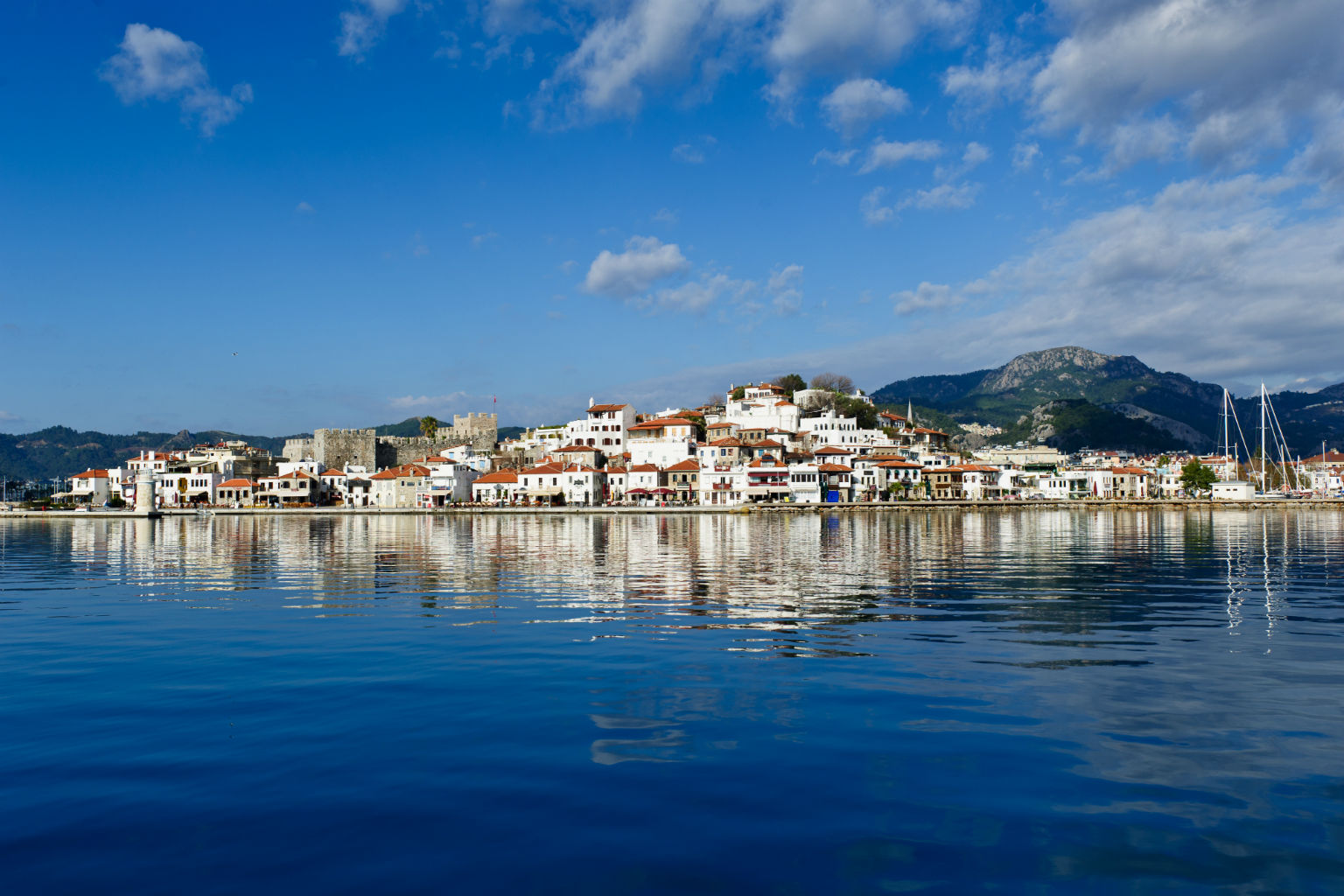
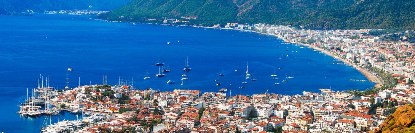
Marmaris is one of the rare towns in Turkey where you can swim right in the city centre, despite the increased construction, as enviromental and water treatment facilites have been installed. For those who seek cleaner seas and quieter spots there are many gulet trips that go to other bays. Stroll and explore the bustling Marmaris bazaar, getting the feeling of being in Asia Minor. Marmaris in recent years has spread out with new hotels and apartments but the old centre still retains its village atmosphere. Marmaris has a great choice of shops and restaurants many with an international flavour. The most important historic building in the town centre is the castle. The first castle built on this site was constructed up by the Ionians, with the present castle you see being built by the Ottomans in 1522. After the Ottoman Sultan Suleyman the Magnificent conquered the city in 1522, many buildings were built which are still visitabl today. Apart from its clean sea and shopping, Marmaris is also famous for its nightlife. Marmaris is accessible by international travellers via Dalaman International Airport (DLM) – Marmaris being 90 minutes and Bodrum Milas International Airport (BJV) – Marmaris being two and half hours.
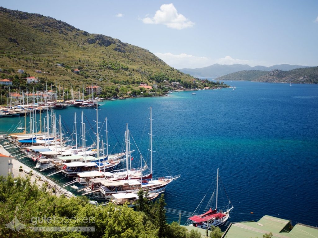
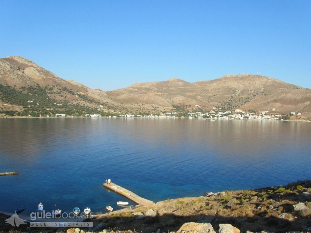
An other place in Hisaronu, named Bozburun is well known to Captains. In respect to tourism it is one of the most virgin parts of the region. Just like the coral waters of the tropical seas, the waters here turn into turquoise fromdark blue. It is highly recommended for those who want a quite and calm holiday. Nearby to Bozburun on Asar Hill are the remains of the ancient city of Larymna. It takes 45 minutes to get to the top of the hill. There are fragments of the city walls, pieces and ruins of tombs scattered around. Bozburun looks beautiful from this hilltop. Another port when you travel towards Bozburun is Sogut Port.
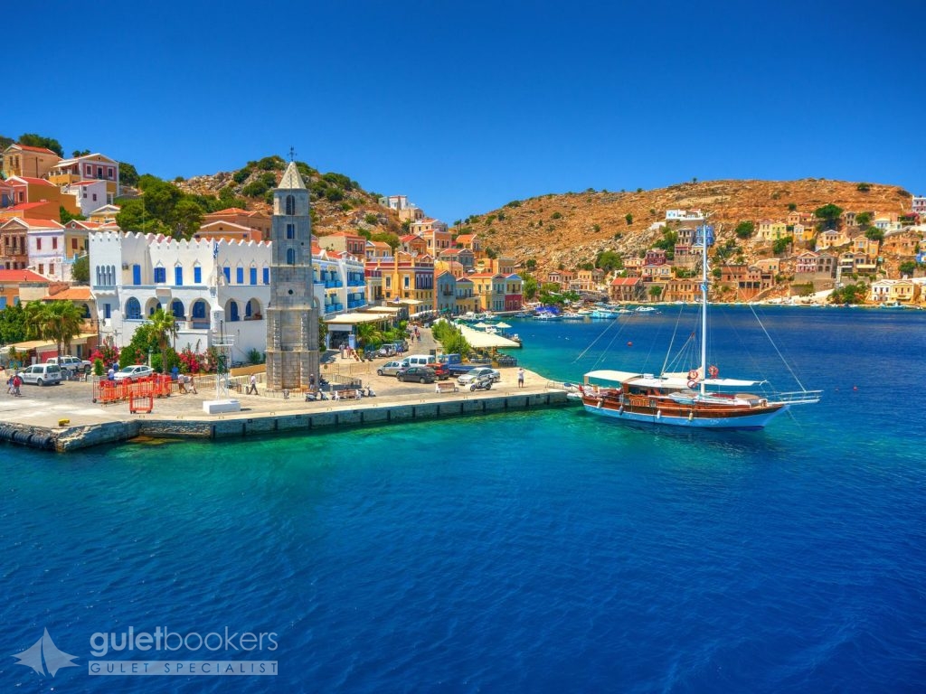
Symi is a cosmopolitan island that has one of the biggest and most beautiful neoclassical towns in the whole country. It boasts a rich tradition in myths as it was first inhabited in the prehistoric times. King Nireas became a legend as he participated in the Trojan War. The locals became engaged in sea sponge harvesting and shipbilding and that is why during the Turkish Occupation (since 1522) the islanders secured firmans of preferential treatment from the Sultan. This is when the School of Agia Marina and Aigli Reading Room were founded. The 19th century is the period of great prosperity for the island when its population had reached 25,000. In 1945, the treaty for the Dodecanese surrender to the Allied Forces was signed on the island. Symi was integrated in Greece in 1948.
The capital town is divided into two large districts. Gialos is the port of the island that never fails to impress visitors with its magnificent neoclassical multi-coloured buildings next to the sea and on the hills and Chorio, the other district, is the larger of the two. Apart from the approximately 3-kilometre asphalted road that connects Gialos and Chorio there is also Kali Strata: 500 wide stone steps climbing uphill and connecting the two districts. Kali Strata is flanked by the largest mansions in Symi.
The ragged, mountainous terrain of Tilos; its densely forested ranges; its hilly vistas; and its verdant valleys, are home to four hundred species of flowers and herbs and the habitat of rare species of birds such as Bonelli’s eagles, hawks, nightingales, goldfinches, herons and bee-eaters. You will find picturesque villages and fascinating beaches. The last elephants on Europe lived here. The dwarf elephants made their appearance on the island 45,000 years ago and became extinct approximately 4,000 ago. The entire island is a huge ecological park and is protected by the relevant international treaties. In antiquity, Tilos was renowned for its herbs. It rose to prominence during the ancient classical times, the period when Irinna, a famous ancient poetess, lived on the island. Megalo Chorio is the island’s capital, 7 km NW of the harbour. Stone houses built according to the island’s unaffected traditional architecture make this small town stand out. Strolls along the narrow alleys are a pleasant pastime. The medieval castle has been built on the location of ancient Tilos town at the top of the hill.
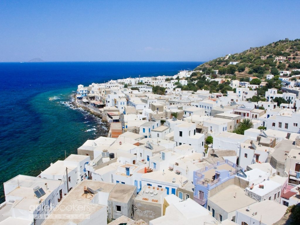
Nisyros is one of the most beautiful Aegean Islands, yet untouched by tourism growth. According to Mythology, the island was created during the Gigantomachy, the battle between the Giants and the Gods. During that battle, Poseidon pursued the Giant Polyvotis to Kos, cut off a piece of the island and hurled it onto the Giant, thus sinking him into the Aegean Sea for eternity. That legendary piece of rock is Nisyros and the eruptions of its volcano are the wrathful breathing of the defeated Giant. Nisyros island was created from these volcanic eruptions making it the “newest” of Greece’s volcanic centres and still an active one – along with the volcanic centres at Milos, Santorini, and Methana. In antiquity, Nisyros had a thriving trade in obsidian which the island’s inhabitants would extract from the nearby island of Gyali.
Beatiful Mandraki is the island’s capital town and port. Its squares feature amazing pebbled paving, and the narrow alleys are flanked by white or coloured two-storey houses with wooden balconies. The houses have been built using volcanic rock and have been insulated with pumice. The volcano is remarkable to see when you arrive to the island. You can walk in the caldera and watch the bubbling steam vents. At the caldera’s bottom there are ten craters in very good condition, each with its own name. The largest and most impressive one is called “Stefanos”. It has an elliptic shape; its longest axis reaches 330 m and the shortest one is 260 m long, while its depth goes down to 27 m. The volcano forms a valley (caldera) that is 2,400 metres long and 950 metres wide.
Anafi is a small paradise with pristine lovely countryside bearing all the features of a typical beautiful Cyclades island. It is located east of Santorini. Mount Kalamos (460 m.) rises on the island’s east side. According to Greek mythology, Anafi was ordered by Apollo to emerge from the bottom of the Aegean, in order to provide shelter to the Argonauts. There is also another version connecting the name of the island with the non-existence of snakes on it (An-ofis: “an” meaning “absence of” and “ofis” meaning snake)! The ancient town of Anafi was founded by Dorians during the 8th century BC. During the Byzantine times, Anafi had suffered pirate raids. In 1537, after interim periods of Venetian rule, the island was occupied by the Turks, following the invasion of Hayreddin Barbarossa who razed the place to the ground. During the 1860s, Anafi’s Chora served as a model for local masons who had migrated in Attica and built the picturesque Anafiotika settlement at the foot of the Acropolis rock in Athens.
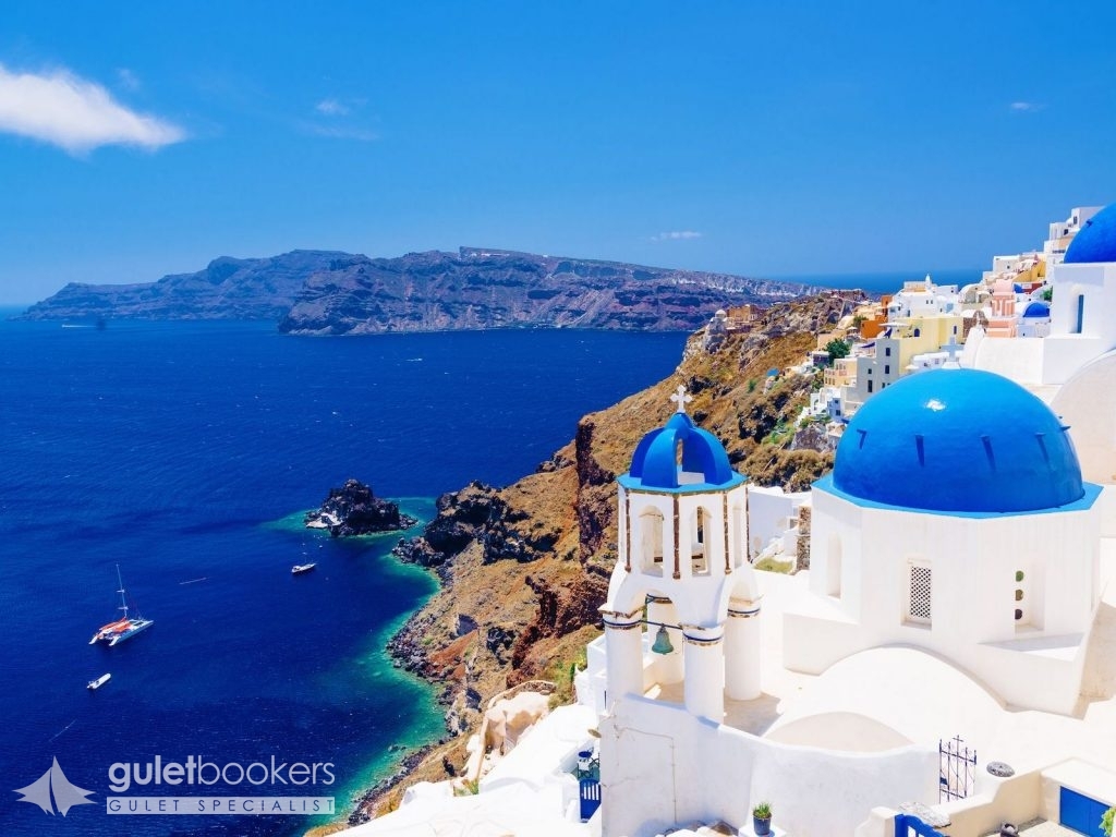
Santorini is one of the best known Greek islands the world over. It is in itself a unique geological phenomenon, as today’s island is what has remained of the initial island, Strongyli (meaning Round), which sunk to the bottom of the sea following an eruption of its volcano during the 16th century B.C. This has been one of the most powerful eruptions in the history of Earth: three quarters of the island were submerged, shaping today’s Caldera. Furthermore, the major aftermath of that eruption was the destruction of the Minoan Palaces in Crete. Santorini’s area is 73 sq. km, its coastal length is 69.5 km and there are 13,670 residents.
Santorini is the southernmost island in the Cyclades group. The island of Santorini is actually a group of islands comprised of Thira, Thirasia, Aspronisi, Palaia Kameni and Nea Kameni (Kameni meaning burned). The island’s architectural heritage is preserved remarkably well in Fira and Oia as well as in other inland villages.
An important prehistoric civilisation thrived on the island, mainly during the Middle Cycladic Period, and was destroyed by the volcanic eruption. In time, the island was repopulated and it flourished during the Hellenistic and Roman times. Later on the Venetians took the island over and remained there for centuries. Over the last decades, Santorini has known a massive tourism growth. Still, the island has remained as appealing as ever, with secrets and places of unspoiled natural beauty yet to be explored, not to mention the lovely sunset for which Santorini has been renowned across the planet. Local wine is famous and the island’s vineyards have been producing it since antiquity. The grape varieties grown here are Asyrtiko, Athiri, Aidani, Mandilaria (red) and Mavrotragano (red). The quality of Vinsanto wine is exceptional and it is produced by mixing two varieties: Asyrtiko and Aidani.
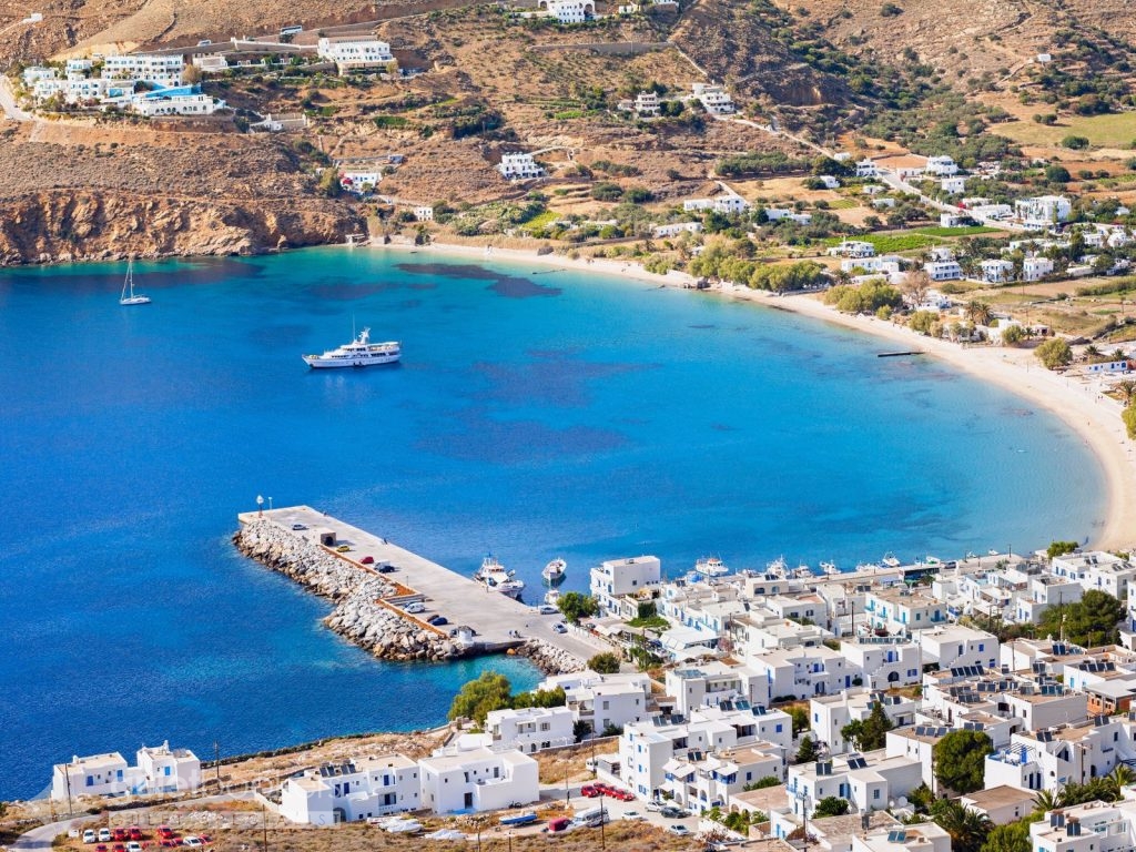
Ios or Nios, as the locals call it, is one of the most beautiful islands of the Cyclades group, known worldwide and preferred by young people for its nightlife. It is surrounded by Santorini, Paros and Naxos and boasts numerous bays and long sandy beaches. 32 km, out of the 81,5 km of coastline, are sandy beaches!
According to ancient tradition, Ios was the homeland of Homer’s mother, but also the burial place of the great epic poet. An Early Cycladic Period settlement was discovered in Skarkos as well as buildings regarded as dating to historical times. Palaiokastro was built during the Byzantine Period at the northeastern side of the island. Ios was under Venetian domination until 1537, when the Turks occupied the island.
Paros is located in the centre of the Cyclades islands, and is considered one of the most popular holiday destinations with unrivalled natural beauty, vast sandy beaches, crystalline seawaters and stunning scenery. This place is a cosmopolitan holiday destination with a well-developed tourism infrastructure. Historically the island of Paros served as an administrative and commercial centre of the Aegean and often became the apple of discord for many conquerors (Romans, Byzantines, Franks, Venetians and Turks), who all left their mark on the island. The ruins in the archaeological sites and the important historical monuments all over the island are testimony to the island’s great prosperity in the past. Paros was renowned in ancient times for its marble and provided the material for creating many famous monuments. This island has been the place of origin of famous ancient Greek sculptors, painters and poets. In 1207 Paros became a part of the Duchy of the Aegean and in 1537 it was conquered by the Turks.
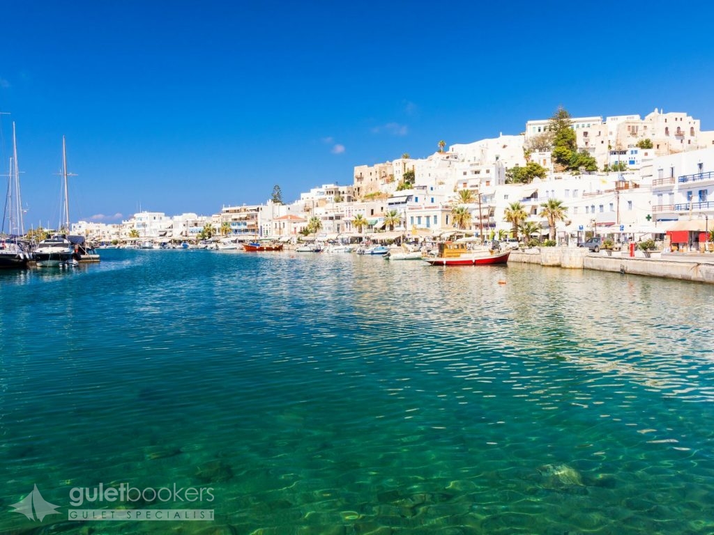
Naxos is the largest and most fertile island of the Cyclades group. It is endowed with an extraordinary landscape, high mountains (mount Zas’ top, reaching 1,004 m., is the highest mountain in Cyclades) and mountainous villages with a singular character.
In antiquity, the god Dionysus was worshipped on the island. According to mythology, Dionysus met a Minoan lady, Ariadne, who had been abandoned by Theseus in Naxos. From the ancient times to the present day the island has been producing citrus fruits of excellent quality, wine that is renowned for its quality and very tasty cheese varieties.
The Carians were the first residents of Naxos, followed by the Cretans and the Ionians. Naxos was already famous in the ancient times for its wine and well known as a worship place of the ancient god Dionysus. During the 6th century BC, Naxos experienced a trading, financial and cultural boom and had been a member of the two Athenian (or Delian) Leagues. During the Venetian occupation, Marco Sanudo founded the Duchy of Naxos (1207). The Venetians remained on the island until 1566. In 1579 it became attached to the Ottoman Empire and from 1830 it is part of the Greek state.
It is the capital town of the island with characteristic Cycladic culture elements and numerous monuments dating to various historical periods. The heart of the town is beating in Old Chora, the old castle town with cobblestone-laid alleys (kalderimia) and the Venetian castle. The houses with Venetian blazons ornamenting their entrances, the narrow arcaded alleys (called “stegadia”), the catholic churches and the fortifications create a unique blend of Cycladic and Mediaeval architecture.
This is the island of “The Big Blue”, a Luc Besson film which was mostly shot in Amorgos. It is located at the easternmost edge of the Cyclades and boasts a singular character. The mountainous landscape with impressive steep mountainsides and cultivation terraces with moderate yields, the steep rocks by the coast in the southern part and the scenic bays with beautiful seashores in the northern part of the island, make up Amorgos topography.
The island has been inhabited since Prehistoric times and prospered during the Cycladic Period. At that time, Amorgos developed a thriving trade, navigation and the arts. Three important ancient cities existed on the island, Minoa, Arkesini and Aigiali. During the Roman times, Amorgos used to be a place of exile. Panagia Hozoviotissa Monastery, its landmark, was built during the Byzantine Period. During the Frankish rule, the island suffered numerous invasions, to be occupied in the 16th century by the Turks. Amorgos participated in the Greek Revolution against the Ottoman Empire in 1821. The traditional Cycladic architectural style is evident in all of the island’s villages where local customs practice and a wellknown musical tradition have survived the test of time. A dense network of hiking trails enables hikers to visit the monuments and enjoy the island’s natural beauty. Its area is 121 sq. Km, its coastline is 112 k. The crest of the island is Mount Krikellos (821 m.)
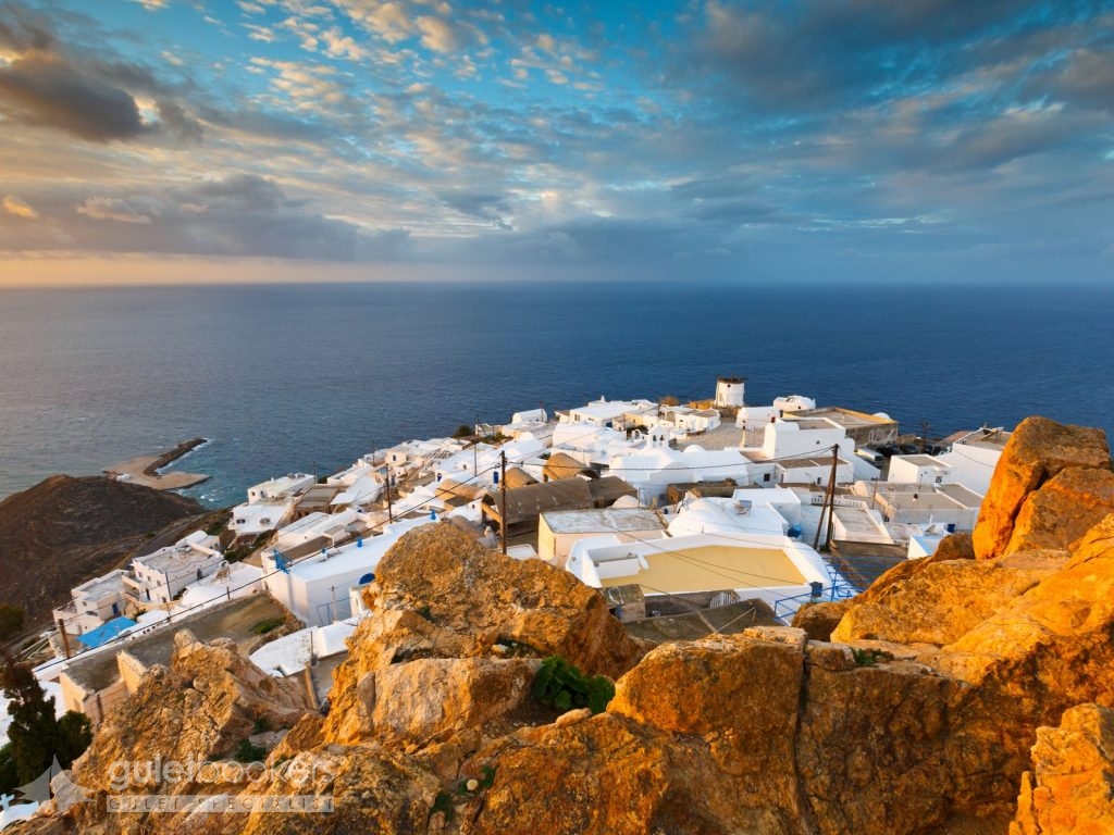
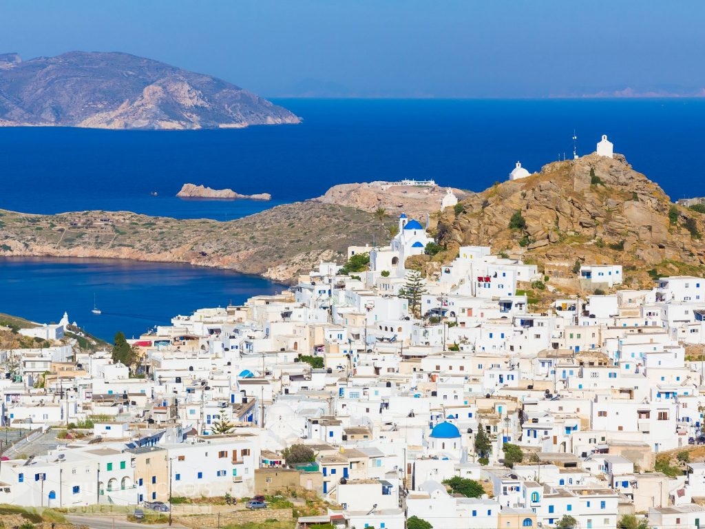
It is considered one of the most picturesque towns in the Cyclades, situated approximately in the middle of the island, surrounded by mountains and a hill with old windmills. A castle atop an imposing rock stands out on the island’s highest location, while at its foot lie the town’s snow-white houses. Old churches, traditional white houses with coloured doors and windows, stone paved narrow alleys, small squares, beautiful terraces, stairs decorated with colourful flower pots, small tavernas and cafés charm the visitor with their particular character.
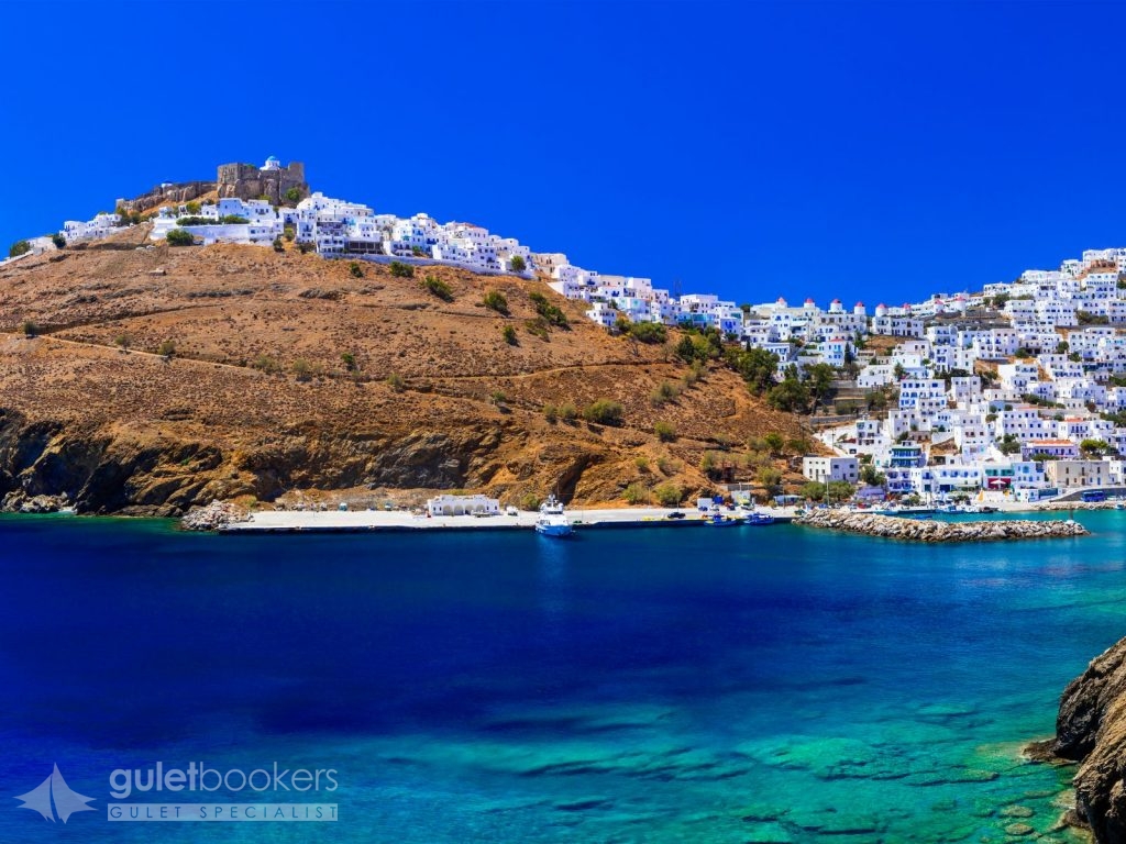
Astypalaia is the westernmost island of the Group, located exactly where the Dodecanese Islands meet the Cyclades Islands. This is why Astypalaia’s landscapes and architecture are quite similar to those found in Cyclades. It is naturally separated into Mesa Nisi [the inner island] (western part) and Exo Nisi [the outer island] (eastern part) by a thin strip of land less than 100 m. wide. The island was named after Astypalaia, the daughter of Phoenix and Perimede. In the old days the island was also called Ichthyoessa due to its abundant fishing grounds. It was first inhabited in prehistoric times. In 1204 it came under the Venetian rule enforced by the Guerini family until 1537 with the exception of a brief period in time (1269-1310) when the Byzantine Empire took over again. In 1537 the Turks occupied the island. As is the case with the other Dodecanese islands, Astypalaia remained under Turkish rule until 1912; it was then conquered by the Italians, the British, and the Germans until it was finally integrated in Greece in 1948.
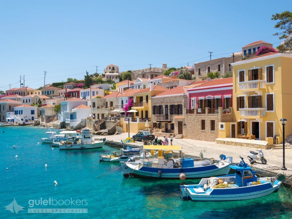
Chalki has been named after the copper (chalkos) mines that used to exist on the island. As of 1983 it has been known worldwide as the “Island of Peace and Friendship” for the young; it offers an enjoyable stay in an enviable serene setting. Chalki prospered in the late 19th century when the islanders became engaged in shipping and the sea sponge trade. Chalki shared the historical path of Rhodes and the island was integrated in the Greek state in 1948. Nimporio is the island’s capital town and has been built in an amphitheatre-like manner, overlooking the crystal-clear blue sea. It keeps a stately beauty, evident in the picturesque alleys and the singular architectural features that adorn the houses; it is one of the most beautiful neoclassical towns in Greece! Chorio used to be the island’s old capital and it was built next to the mighty castle of the Knights Hospitaller of the Order of St John for protection against the pirates. Once the pirate threat had been removed, the locals founded Chalki town or Nimporio (1850-1870) and built magnificent mansions; the latter manifest today the island’s past prosperity times. Chalki has been listed as a heritage town.
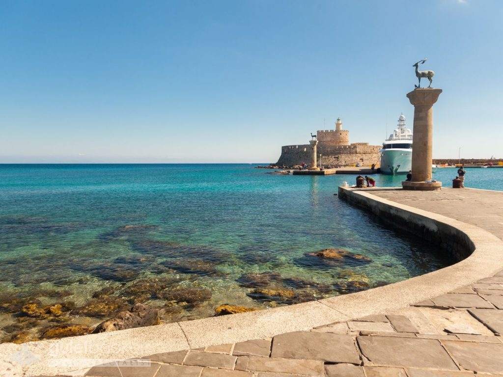
Rhodes is the fourth largest island in Greece, after Crete, Evoia and Lesvos. Endless stretches of coastline and pine forests on mountains dotted with villages, archeological sites, and a medieval city of exceptional beauty attract over a million tourists every year. Rhodes is the largest of the Dodecanese Group with an area of 1,398 sq. Km, a coastline that reaches 220 km. It has been populated since prehistoric times and flourished during the Mycenaean period. It enjoyed great prosperity in the 4th c. BC when the Colossus of Rhodes was erected, a work of art by Chares from Lindos, Rhodes, a disciple of the sculptor Lysippos. After the destructive earthquake in 155 AD, Rhodes knew many conquerors (Persians, Arabs, Saracens and Selzuk Turks). In 1309, the Knights Hospitaller [Order of the Knights of Rhodes] acquired the island and restored the castle adding fortifications that were unmatched in Europe at the time. This castle remained the seat of the Knights until 1522 when the Turks conquered it after tough fights. In 1912, Rhodes became occupied by the Italians until 1948, when Dodecanese became integrated in the Greek state.
The capital of the island is considered to be one of the most beautiful cities worldwide. It was founded in 408 BC. Its medieval architectural features blend with the modern style in buildings. The city comprises the old, fortified medieval town and the modern one, with its old, neoclassical buildings and other recent structures. The medieval town is a UNESCO World Heritage Monument and has been built in a semi-circular fashion around the central harbour.
Send Enquiry Marmaris – South Dodecanese & Cyclades Islands Cruise
This itinerary is only bookable for private charters. If you are interested in a cabin charter, please contact us for more information.
Guletbookers is the independent gulet charter company located in Bodrum - Turkey and dedicated to giving you
the best gulet charter possible from the widest choice of gulets possible.
Get in touch via WhatsApp for Seamless Communication.
Talk to our experts and browse through more yachts.