Gocek to Bodrum Cruise including Greek Islands
14 Nights Gocek Yacht Charter Itinerary
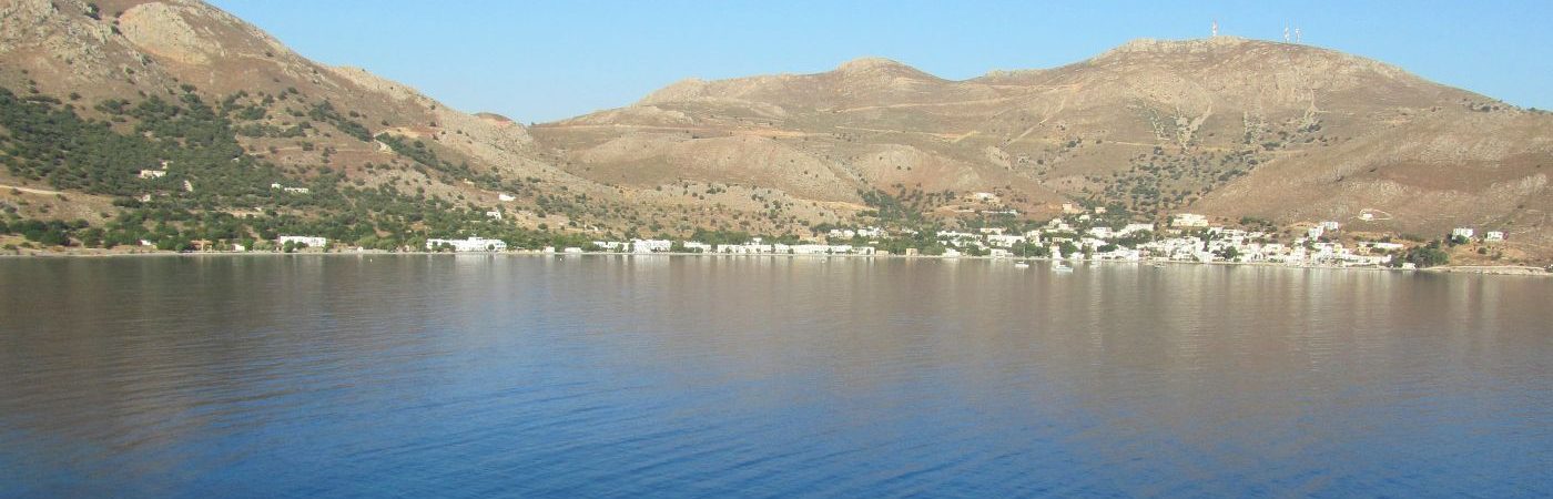
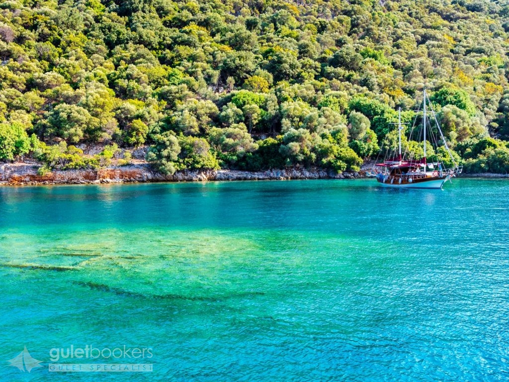
International Dalaman Airport is only 20 km away from to the town center. The Gocek region in Fethiye Gulf has numerous beautiful coves and islands and is extremely popular among the yachts or gullets on the Blue Cruise. In Gocek there are four marinas where all services are available for yachts. The Göcek coves and islands are the meeting place of Turkey’s and the world’s “high society”. Boats that compete in luxury with each other sail through out the region. Göcek is a calm and quite village where tall buildings has not been granted. The tourism activity of Gocek can said to be almost fully focused around the marina, with all the restaurants and shops being around the quay. The walking trail on the seaside that existed until recently has been removed after becoming shabby. By setting up new paths with a design in harmony with the environment, both locals and foreigners can be at peace with the sea. You can stay in Göcek, this corner of heaven of Turkey, and have a full holiday.
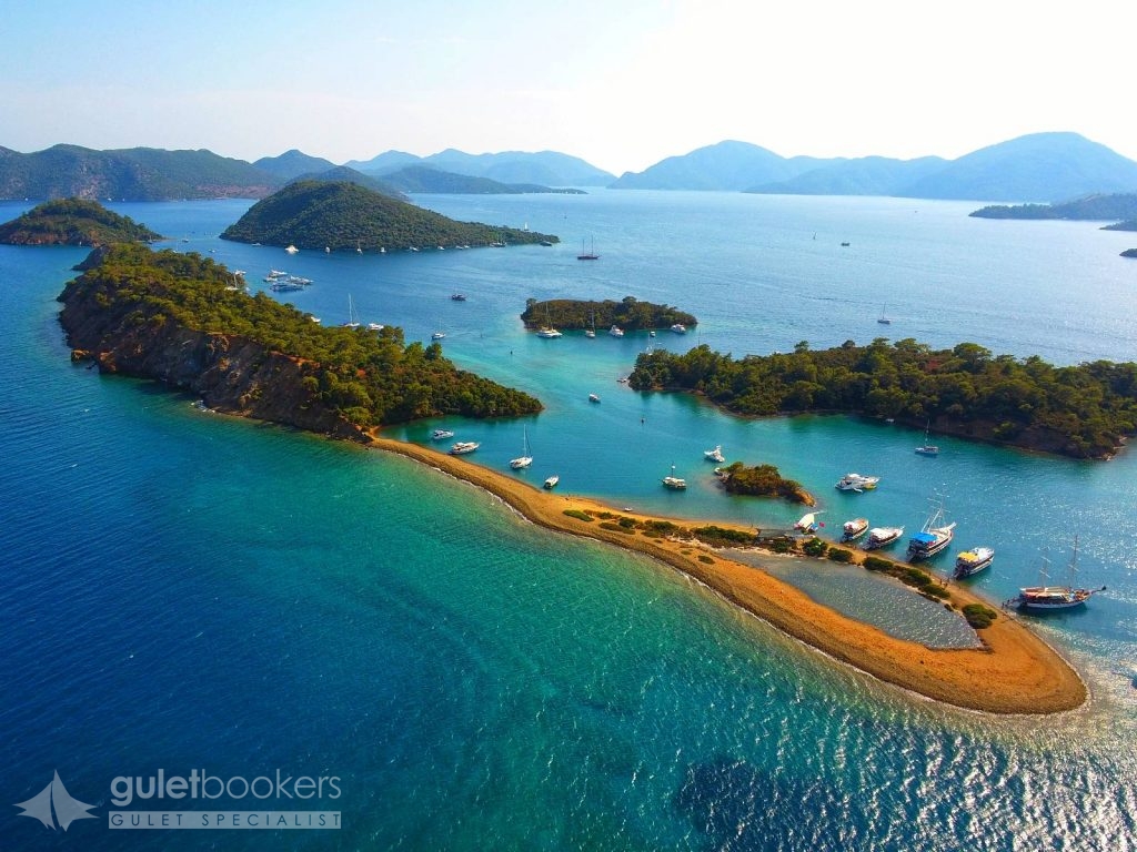
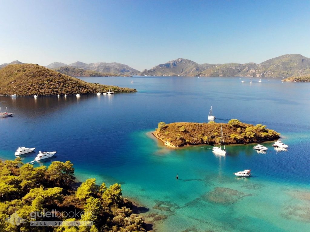
This group of islands are so small that no one could came up with names for each of them. They are together known as Yassicalar. There are no facilites on the islands. On the largest island of the group the beach is near the point and forms a small pool, excellent for children. One is able to swim between the different islets, the closest being just 12 metres distance. If you can swim for half an hour, you can visit four different islands and, if you have shoes with you, you can walk over on each of them.
The Taskaya Bay is one of the most beautiful coves of the region. There are always numbers of yacht moored there. There is a fountain with sweat water, a gravel stone beach lined with oleander, a Picture of a fish by famous Turkish artist Bedri Rahmi Eyübo?lu who was one of the early sailors of the Blue Cruise and the Picture of a kite made from gravel by another artist, Azra Erhat. All these features add interest to the region. To the North of the fountain there are the tombs cut into the rock and, in the flat area, there is a restaurant serving to the boats and a spring of cold spring water. The spring is surrounded with a concrete Wall and has been turned into a small pool. On hot summer days the pool attracts many people.
Gobun cove is to the South of Domuz Island. It has a very narrow entrance, and is a long cove surrounded with pine and olive trees. Those who go ashore at the end point of the cove will come across ancient ruins and rock tombs. Even though its not being on the route of Daily trip boats, it is a much loved stopping point for boats and yachts on the Blue Cruise.
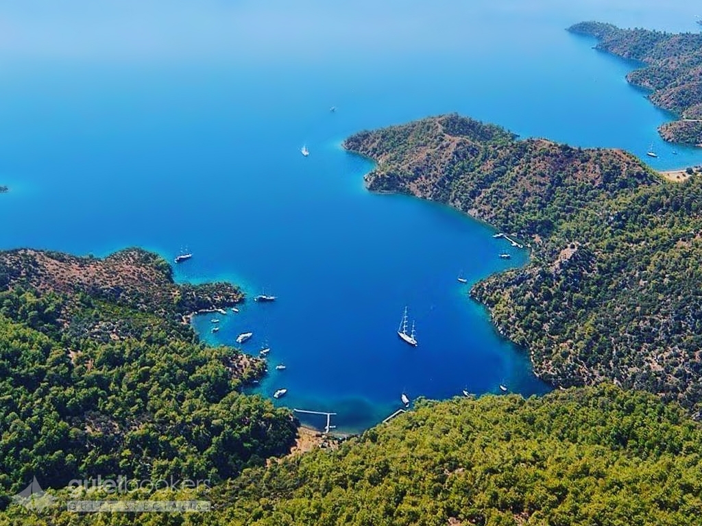
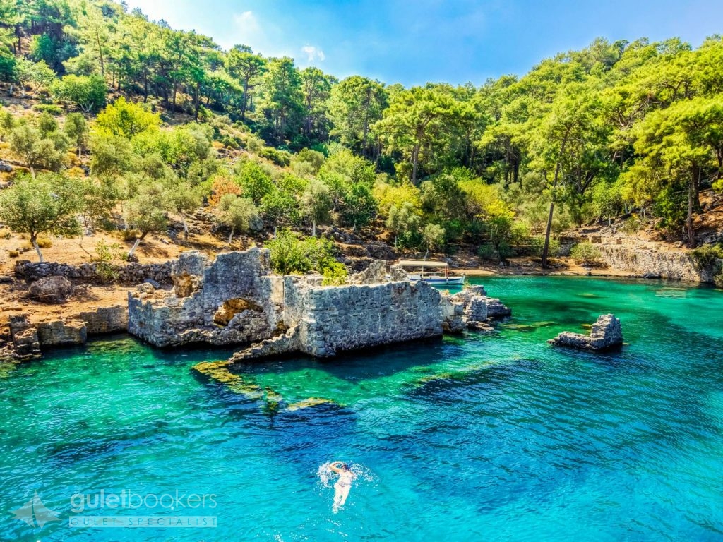
This is the region where Kapi (Door) and the Hamam (The Bath of Cleopatra) Coves are to be found, very popular points on the Gocek tour. Both the Hamam and the Kapi Coves are like swimming pools. This island is one of the bay that the boats and yachts on the Blue Cruise cannot pass without visiting. The Blue Cruisers love to spend the night here. Those who take a stroll among the olive trees come across a wall of four or five meters high. The Wall, although some parts are falling down, is still fairly well preserved and was built to protect the ancient cities above Kapidag and runs all the way across the neck. Those who get on top and follow the route parallel to the wall can get a view of the port of Gokgemile and open sea. Another path leads wanderers to Hamam Cove. Gulets mooring in the port of Hamam can see the ruins of a bath. These ruins are believed to be the ones Cleopatra has once bathed in so this is why this cove is also known as the Cove of Cleopatra. Right next to the quay you will see the ruins of a monastery, which is partly under water. You may enjoy having a pleasant walk on the shore and in the forest if you get off the gulets.
It is believed that it has taken its name from the wild boars living on that island once upon a time. The island is also called Prince Island referring to a prince living on here. The island is covered with pine and olive trees. There is a shallow area of 30 to 40 metres in diameter in the middle of the cove where there are ruins from the Lycian and Roman ages. The highest of the ruins are a meter below the surfaceof the water. It is very pleasant to swim over the ruins, especially when wearing the googles. Yachts and gullets can easily anchor and moor in the cove of the island as it is sheltered from the winds.
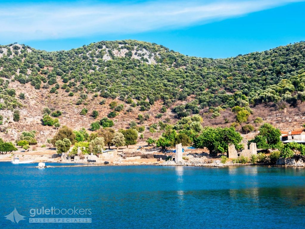
On your trip you come across a monitoring tower and a shipyard, a tersane in Turkish, after which the island is named. Tersane Island (Shipyard Island) is the largest island in the Gulf of Gocek and Tersane cove is the largerst on the gulf. After the population exchange between Greece and Turkey in 1922, the area was mainly inhabited by Greeks. In the flat lands behind the cove are the ruins of a few houses and a church. With a walk of ten minutes you can get to another cove. Sailors call the two coves “summer” and “winter”, both of which are popular stopping points for daily boat tours and the Blue Cruise.
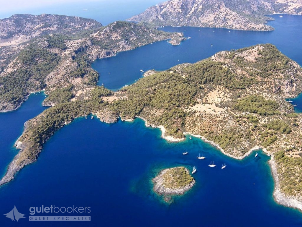
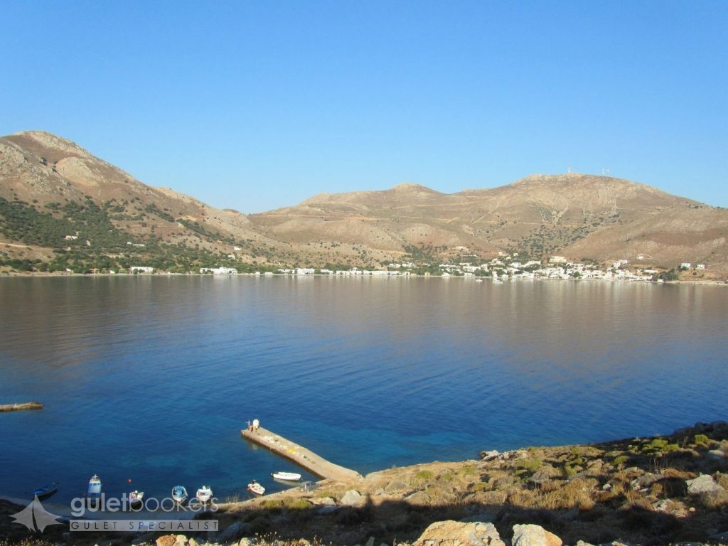
When you get towards the Gocek Gulf, the most popular destinations are AGA PORT and KOCABUK. The Aga Port consists of one small an done large harbour. Both end in a beach area. Those who follow the path upwards from Buyuk (Large) Aga port can get to Roman and Byzantine ruins in the Koyici region. Another leads you up the hill to the west and to the point of the Kapidag Peninsula that has a lake on the park. There are three or five houses around the lake, and a terrific view from above. After Aga Port you get to Kocabuk, Gobun Island and then to the Gulf of Gocek. The coves and the islands in the gulf have been declared a Special Environment Protected Region since 1988.
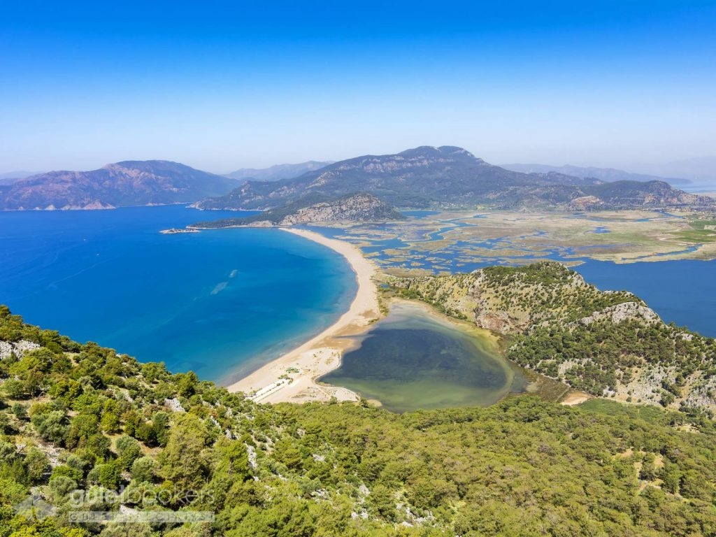
Iztuzu
The coast of Iztuzu became World famous thanks to the Caretta Caretta turtles. On one side of the coast are the Iztuzu beach facilities and on the other side are the Dalyanagzi day-outing beach facilities. This beautiful coast goes on four kilometres on end. There are suitable places high enough to take photographs as one gets closer to the beach. This panorama includes all of the delta and the coast. Iztuzu, quite apart from the Caretta Caretta turtles, is simply a wonderful gift of nature. And they come to the beach on here coast to lay their eggs. Their lenght is about 1-1.5 metres and they weigh as much as 150 kg. There is magnificent scenery of in a type seen in labyrinths, with the 5.4 kilometre along coast going round and round the marshes. On the coast around Dalyan during all seasons the turtles ranging up to one metre in lenght can be seen.
The ancient city of Kaunos / Optional Tour
From the wharf near the ruins reachable from Dalyan by boat it is just a 10 minutes walk to the ruins of the ancient city of Kaunos. Those coming by yachts can drop anchor around Delikli Ada and go ashore by small boat. Kaunos was a significant trading port, through it lost its strategic importance as the alluvial sands filled the harbour. According to the father of history, Heredots, the people of Kaunos were natives of Caria who considered themselves to be Cretans. The rock tombs that can be seen from as far as Dalyan were built in 4 BC and were also used during the Roman period later. In Lycian type tombs the dead were placed on rock beds.
Dalyan
The cute little holiday destination known as Dalyan is located on the shores of the fjord like natural channel, called Calbis in ancient times, which links Lake Köycegiz to the sea. With the start of tourism development in recent years and threat of the danger to the environment led to the area being declared by the state as a special protection district in 1998. This measure helped to protect the region from over development. The village of Dalyan, without a change in its natural beauty for many years, is today still very far from the threat of excessive development.
Boats are all lined up along the channel in Dalyan. These channel are no more than places to cruise around and see as far as they are concerned. The boats are used as a private or shared boats for rent to enable tourista to the see the Iztuzu coast, the ancient city of Kaunos, the rock tombs and the sites of mud baths.
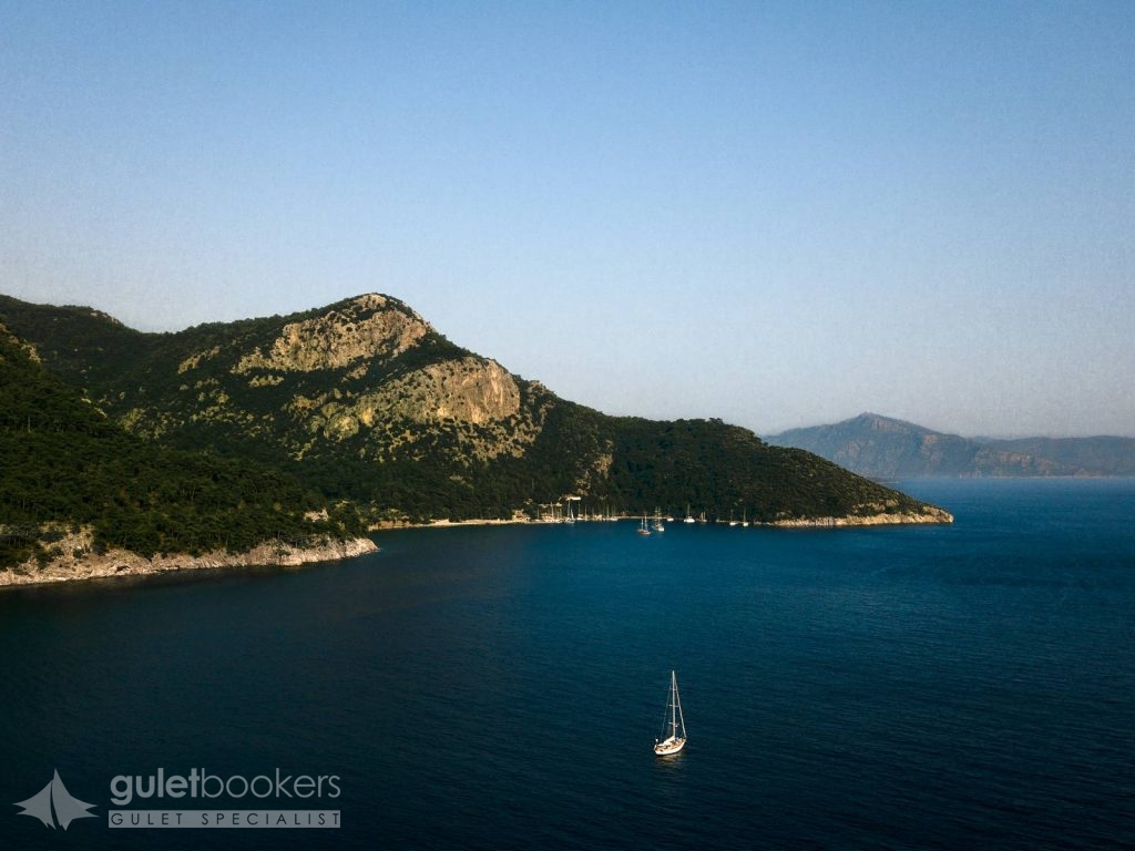
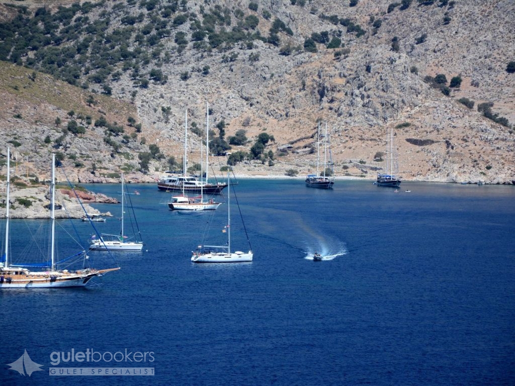
One of the main stopping points for the gulets that cruise along bays between Marmaris and Gocek is Ekincik Cove. First you will see through the beautiful village of Ekincik, surrounded by gree. And than you get into the cove itself, which is extremely clean and has not been suffocated by heavy building. You are surrounded by forests while in front of you there is the beach and the sea. The beach is very beautiful and the water very clean. On its western part, among the popular stopping or overnighting coves there are Semizce, Kargi and Karacay. There are two anchoring points in the port of Ekincik. One of them is Köy Önü (In front of the village) In the area where the road meets the beach there is a quay where yachts can moor.
Serce
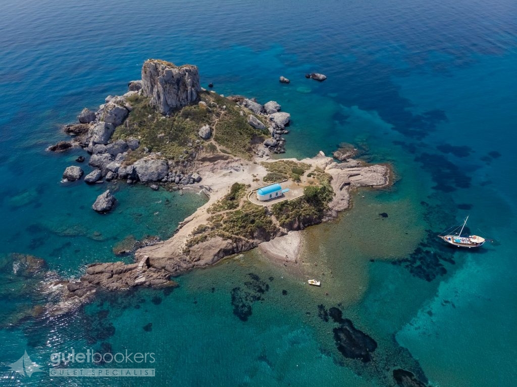
Along the peninsula, and heading to the south-east, lies the bay of Serce – a large bay hidden behind steep cliffs. It was here that George Bass discovered a shipwreck, and its artifacts are now on display at the Museum of Underwater Archaeology, in Bodrum Castle.
Bozukkale (Loryma)
Bozukkale or the ruins of the ancient city of Loryma, which are among the poplar stopping points for the boats running from Marmaris to Gulf of Hisaronu. The gulf of Bozukkale, which is sheltered against the wind, is one of the most important spot of the Blue Cruises. The gulf, due to its sheltered natre, was of strategic importance throughout history. In 1412 BC, the Athenian fleet anchored here and in 395 BC the navy was based in here before the Knidos war. The ruins of the ancient Loryma are at the entrance of the cove on the hill that overlooks the gulf. The most important remains from that time is the castle, which is 120 metres long and ten metres wide and is in a fairly good condition. The castle was built in order to protect the entrance to gulf and in time was fortified.
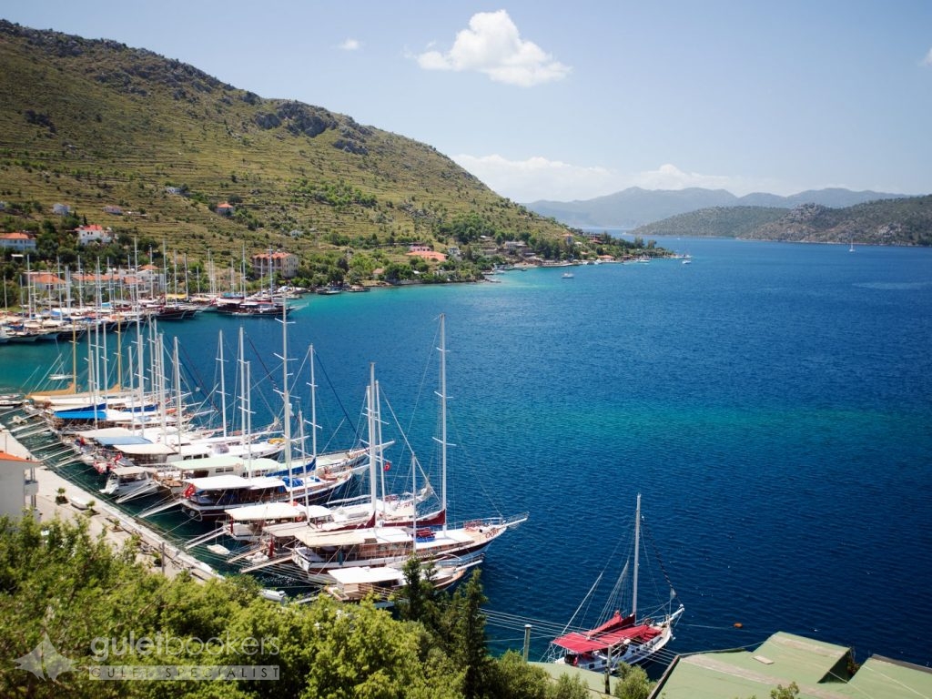
An other place in Hisaronu, named Bozburun is well known to Captains. In respect to tourism it is one of the most virgin parts of the region. Just like the coral waters of the tropical seas, the waters here turn into turquoise fromdark blue. It is highly recommended for those who want a quite and calm holiday. Nearby to Bozburun on Asar Hill are the remains of the ancient city of Larymna. It takes 45 minutes to get to the top of the hill. There are fragments of the city walls, pieces and ruins of tombs scattered around. Bozburun looks beautiful from this hilltop. Another port when you travel towards Bozburun is Sogut Port.
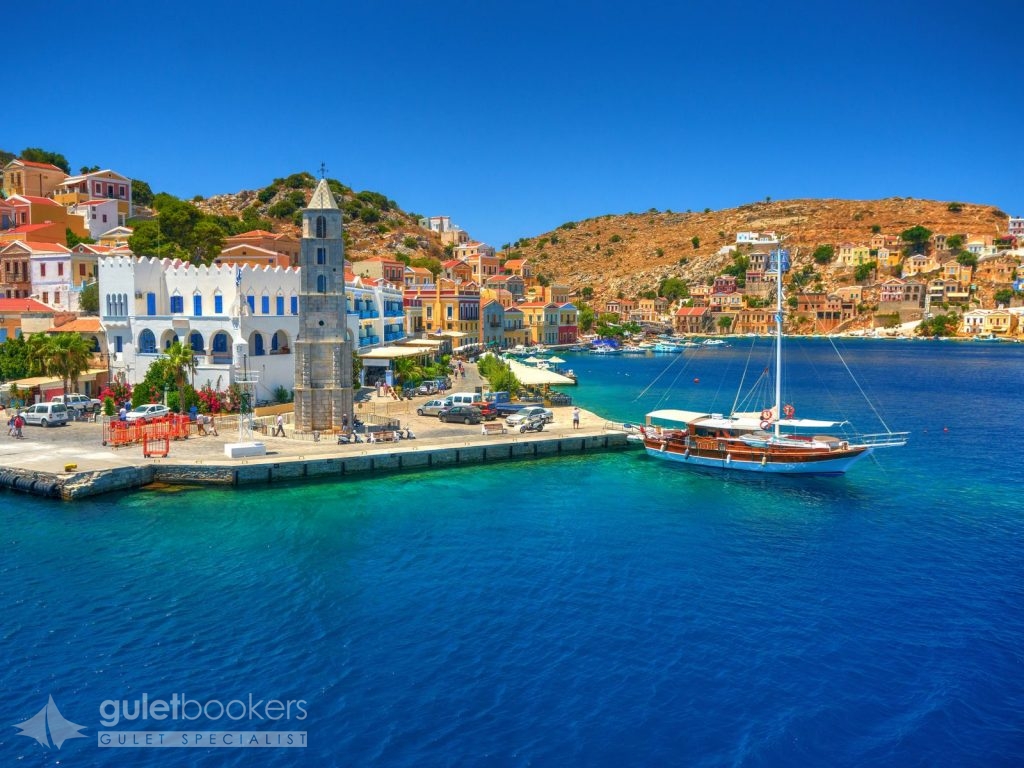
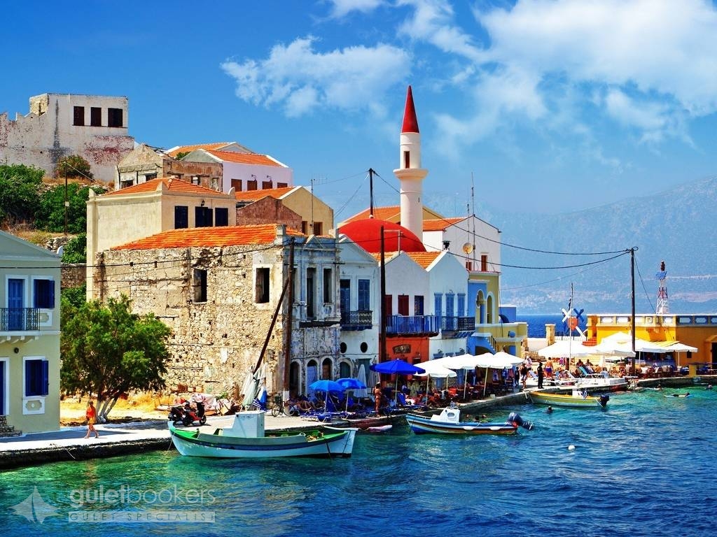
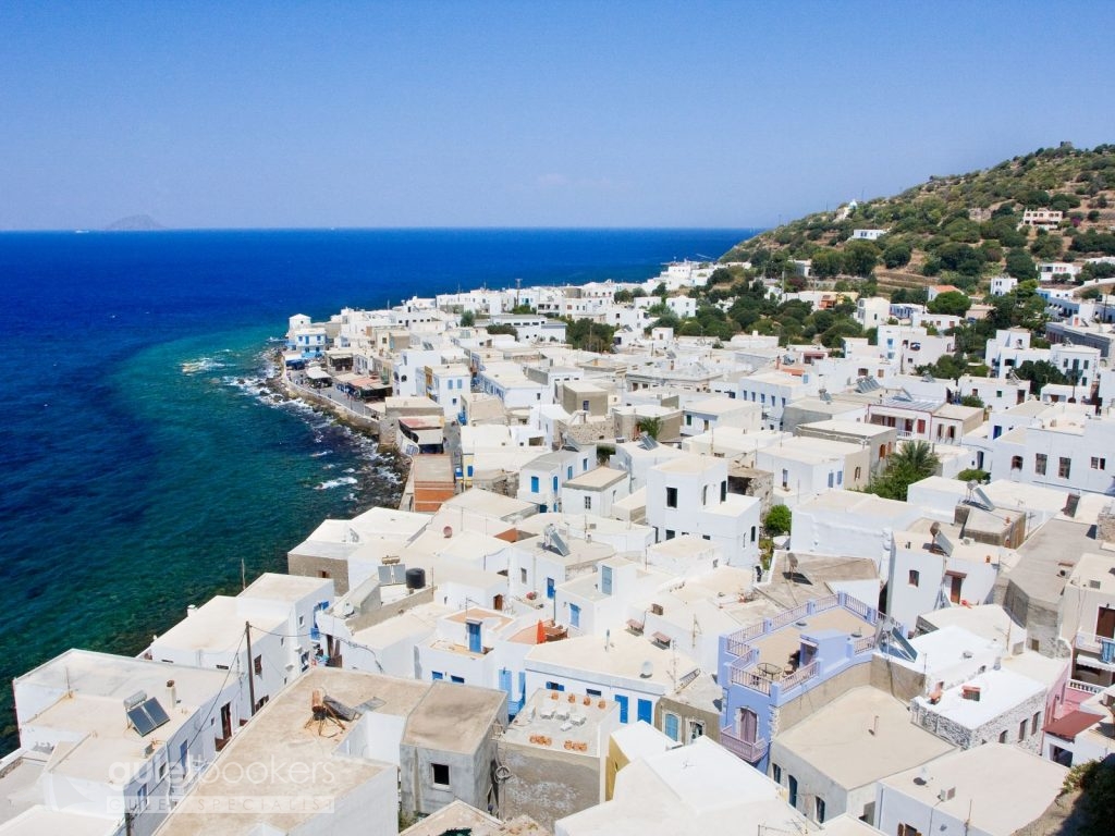
Symi is a cosmopolitan island that has one of the biggest and most beautiful neoclassical towns in the whole country. It boasts a rich tradition in myths as it was first inhabited in the prehistoric times. King Nireas became a legend as he participated in the Trojan War. The locals became engaged in sea sponge harvesting and shipbilding and that is why during the Turkish Occupation (since 1522) the islanders secured firmans of preferential treatment from the Sultan. This is when the School of Agia Marina and Aigli Reading Room were founded. The 19th century is the period of great prosperity for the island when its population had reached 25,000. In 1945, the treaty for the Dodecanese surrender to the Allied Forces was signed on the island. Symi was integrated in Greece in 1948.
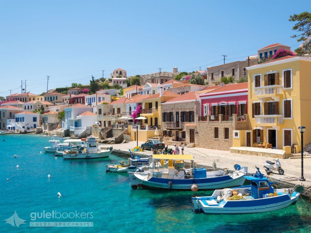
The capital town is divided into two large districts. Gialos is the port of the island that never fails to impress visitors with its magnificent neoclassical multi-coloured buildings next to the sea and on the hills and Chorio, the other district, is the larger of the two. Apart from the approximately 3-kilometre asphalted road that connects Gialos and Chorio there is also Kali Strata: 500 wide stone steps climbing uphill and connecting the two districts. Kali Strata is flanked by the largest mansions in Symi.
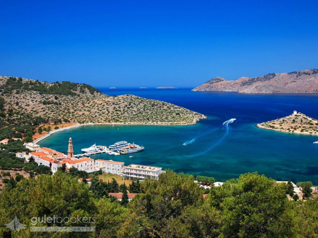
Panormitis is located South area of the Symi island. Many people come to Symi to worship before the wonder-working icon of Archangel Michael that is covered in silver and gold. It is kept at the monastery of Taxiarchis Michail Panormitis, one of the most significant monasteries in the Dodecanese, built in the nook of Panormos bay. There is an imposing multi-coloured belfry at its entrance, erected in 1911. The monastery’s church was built in 1783. It is a single-naved spacious basilica with rare 18th-century murals, cross vaults, and an elaborate woodcarved iconostasis dating back to 1787.
Rhodes is the fourth largest island in Greece, after Crete, Evoia and Lesvos. Endless stretches of coastline and pine forests on mountains dotted with villages, archeological sites, and a medieval city of exceptional beauty attract over a million tourists every year.
Rhodes is the largest of the Dodecanese Group with an area of 1,398 sq. km, a coastline that reaches 220 km. It has been populated since prehistoric times and flourished during the Mycenaean period. It enjoyed great prosperity in the 4th c. BC when the Colossus of Rhodes was erected, a work of art by Chares from Lindos, Rhodes, a disciple of the sculptor Lysippos. After the destructive earthquake in 155 AD, Rhodes knew many conquerors (Persians, Arabs, Saracens and Selzuk Turks). In 1309, the Knights Hospitaller [Order of the Knights of Rhodes] acquired the island and restored the castle adding fortifications that were unmatched in Europe at the time. This castle remained the seat of the Knights until 1522 when the Turks conquered it after tough fights. In 1912, Rhodes became occupied by the Italians until 1948, when Dodecanese became integrated in the Greek state.
The capital of the island is considered to be one of the most beautiful cities worldwide. It was founded in 408 BC. Its medieval architectural features blend with the modern style in buildings. The city comprises the old, fortified medieval town and the modern one, with its old, neoclassical buildings and other recent structures. The medieval town is a UNESCO World Heritage Monument and has been built in a semi-circular fashion around the central harbour.
Chalki has been named after the copper (chalkos) mines that used to exist on the island. As of 1983 it has been known worldwide as the “Island of Peace and Friendship” for the young; it offers an enjoyable stay in an enviable serene setting. Chalki prospered in the late 19th century when the islanders became engaged in shipping and the sea sponge trade. Chalki shared the historical path of Rhodes and the island was integrated in the Greek state in 1948. Nimporio is the island’s capital town and has been built in an amphitheatre-like manner, overlooking the crystal-clear blue sea. It keeps a stately beauty, evident in the picturesque alleys and the singular architectural features that adorn the houses; it is one of the most beautiful neoclassical towns in Greece! Chorio used to be the island’s old capital and it was built next to the mighty castle of the Knights Hospitaller of the Order of St John for protection against the pirates. Once the pirate threat had been removed, the locals founded Chalki town or Nimporio (1850-1870) and built magnificent mansions; the latter manifest today the island’s past prosperity times. Chalki has been listed as a heritage town.
The ragged, mountainous terrain of Tilos; its densely forested ranges; its hilly vistas; and its verdant valleys, are home to four hundred species of flowers and herbs and the habitat of rare species of birds such as Bonelli’s eagles, hawks, nightingales, goldfinches, herons and bee-eaters. You will find picturesque villages and fascinating beaches. The last elephants on Europe lived here. The dwarf elephants made their appearance on the island 45,000 years ago and became extinct approximately 4,000 ago. The entire island is a huge ecological park and is protected by the relevant international treaties. In antiquity, Tilos was renowned for its herbs. It rose to prominence during the ancient classical times, the period when Irinna, a famous ancient poetess, lived on the island. Megalo Chorio is the island’s capital, 7 km NW of the harbour. Stone houses built according to the island’s unaffected traditional architecture make this small town stand out. Strolls along the narrow alleys are a pleasant pastime. The medieval castle has been built on the location of ancient Tilos town at the top of the hill.
Nisyros is one of the most beautiful Aegean Islands, yet untouched by tourism growth. According to Mythology, the island was created during the Gigantomachy, the battle between the Giants and the Gods. During that battle, Poseidon pursued the Giant Polyvotis to Kos, cut off a piece of the island and hurled it onto the Giant, thus sinking him into the Aegean Sea for eternity. That legendary piece of rock is Nisyros and the eruptions of its volcano are the wrathful breathing of the defeated Giant. Nisyros island was created from these volcanic eruptions making it the “newest” of Greece’s volcanic centres and still an active one – along with the volcanic centres at Milos, Santorini, and Methana. In antiquity, Nisyros had a thriving trade in obsidian which the island’s inhabitants would extract from the nearby island of Gyali.
Beatiful Mandraki is the island’s capital town and port. Its squares feature amazing pebbled paving, and the narrow alleys are flanked by white or coloured two-storey houses with wooden balconies. The houses have been built using volcanic rock and have been insulated with pumice. The volcano is remarkable to see when you arrive to the island. You can walk in the caldera and watch the bubbling steam vents. At the caldera’s bottom there are ten craters in very good condition, each with its own name. The largest and most impressive one is called “Stefanos”. It has an elliptic shape; its longest axis reaches 330 m and the shortest one is 260 m long, while its depth goes down to 27 m. The volcano forms a valley (caldera) that is 2,400 metres long and 950 metres wide.
Endless beaches with turquoise waters; lush vegatation and abundantly flowing streams; ancient and medieval monuments; grand edifices of Italian architecture all come to spell one word: Kos, the third largest island of the Dodecanese Group, only 4 miles away from the coast of Turkey. It is said that the island was named after the daughter of Merops, an ancient king – according to legend – who was also known as Koos. It is the birthplace of Hippocrates, the “Father of Medicine” (460-377 BC). It has been populated since neolithic times (5th-4th millenium BC). In the 14th c., the Knights Hospitaller of the Order of St John took over the island, strengthened the fortifications of older castles and built new ones. During the Turkish Occupation, the island suffered onslaughts by many invaders (the Knights, the Venetians, etc.). A number of monumental public buildings were constructed during the Italian rule (1912-1945). The island was integrated in Greece in 1948.
Bodrum has a history that goes back to the 12 th century B.C. The city which was called ‘Halicarnassus’ was the birthplace of Herodotus; the ‘Father of History’ who lived in the 5th century B.C. The ‘Mausoleum’ of King Mausolus (350 B.C.) which is one of the Seven Wonders of the World is in this city. The only structure that survived from the Classical Era is the Amphitheatre. Another place that you should visit when you arrive in Bodrum is the landmark of the city ‘Castle of Saint Peter’. It is one of the best preserved piece of work whose history goes back to the Middle Ages.
Bodrum Harbour is 20 minutes from Bodrum- Milas (BJV) International Airport. Besides its wealth of history, Bodrum is also famous for its nature,crystal and clean sea/bays/beaches and nightlife.
Send Enquiry Gocek to Bodrum Cruise including Greek Islands
This itinerary is only bookable for private charters. If you are interested in a cabin charter, please contact us for more information.
Guletbookers is the independent gulet charter company located in Bodrum - Turkey and dedicated to giving you
the best gulet charter possible from the widest choice of gulets possible.
Get in touch via WhatsApp for Seamless Communication.
Talk to our experts and browse through more yachts.